


Visit Mindanao!

Region IX
Region IX

Region X
Region XI
The Region IX of Mindanao is composed of Zamboanga del Norte, Zamboanga del Sur and Zamboanga Sibugay.
Vulnerability of Natural disasters:
Decrease in Rainfall due to El Nino: Very High
Typhoon Hits: Very low
Projected Rainfall change: Low
Projected Temperature change: High
Tsunami prone areas: High
Distribution of Volcanoes: Inactive
Earthquake Prone Areas: High danger zone
The Region X of Mindanaois composed of Bukidnon, Camiguin, Lanao del Norte, Misamis Occidental and Misamis Oriental.
Vulnerability of Natural disasters:
Decrease in Rainfall due to El Nino: High and Very High
Typhoon Hits: Low and Very Low
Projected Rainfall change: Low
Projected Temperature change: High
Tsunami prone areas: High Potential
Distribution of Volcanoes: Active, Potentially active and Inactive
Earthquake Prone Areas: High danger zone
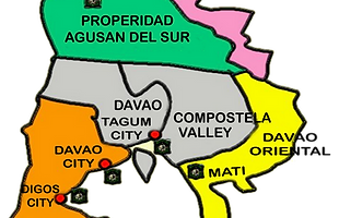
The Region XI of Mindanao is composed of Compostela Valley, Davao del Norte, Davao del Sur, Davao Oriental.
Vulnerability of Natural disasters:
Decrease in Rainfall due to El Nino: Very High
Typhoon Hits: Very low
Projected Rainfall change: Very low
Projected Temperature change: High
Tsunami prone areas: High Potential
Distribution of Volcanoes: Inactive
Earthquake Prone Areas: Very High Zone
Region XII

Region XIII

ARMM
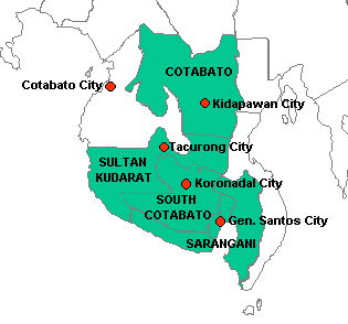
The Region XII of Mindanao is composed of Cotabato (North Cotabato), Sarangani, South Cotabato and Sultan Kudarat.
Vulnerability of Natural disasters:
Decrease in Rainfall due to El Nino: Very High
Typhoon Hits: Very low
Projected Rainfall change: Low
Projected Temperature change: High
Tsunami prone areas: High Potential
Distribution of Volcanoes: Active, Potentially Active and Inactive
Earthquake prone areas: Very High Zone
The Region XII of Mindanao is composed of Agusan del Norte, Agusan del Sur, Dinagat Islands, Surigao del Norte and Surigao del Sur.
Vulnerability of Natural disasters:
Decrease in Rainfall due to El Nino: High
Typhoon Hits: Low
Projected Rainfall change: Medium
Projected Temperature change: High
Tsunami prone areas: High Potential
Distribution of Volcanoes: Inactive
Earthquake prone areas: High Danger Zone
The Region ARMM of Mindanao is composed of Basilan, Lanao del Sur, Maguindanao, Shariff Kabunsuan, Sulu and Tawi-Tawi.
Vulnerability of Natural disasters:
Decrease in Rainfall due to El Nino: Very High
Typhoon Hits: Very low
Projected Rainfall change: Low
Projected Temperature change: High
Tsunami prone areas: Potential and High Potential
Distribution of Volcanoes: Active, Potentially Active and Inactive
Earthquake prone areas: High Danger Zone


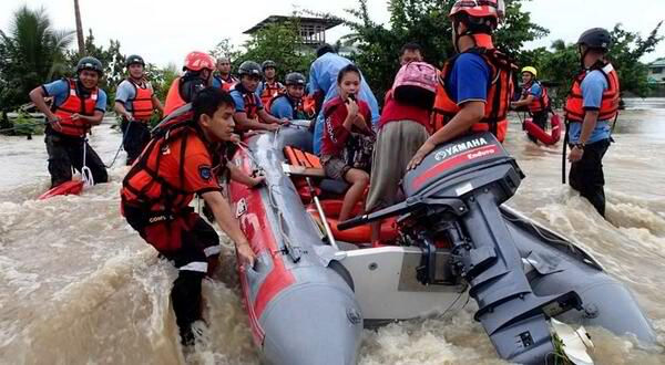
Hazards may be categorized into natural and anthropogenic hazards. Climate and weather-related hazards, such as typhoons and droughts, as well as geophysical hazards, like earthquakes, volcanic eruptions and tsunamis, are natural hazard. Anthropogenic, or man-made, hazards include deforestation, mining and climate change.